Whatawhata Integrated Catchment Farm
This long-term project began in the 1990s to examine the impact of land use and management change on the system performance of a Waikato hill country catchment farm. The multi-stakeholder group established sustainable agriculture goals at the outset and monitored farm performance, water quality, greenhouse gas profile and indigenous biodiversity to verify expected improvements.
Download factsheet
Pine forestry (pdf 1.1 MB)Download factsheet
Full catchment (pdf 1.3 MB)Presentations
Environmental impact summary
Download summary
NIWA - Summary of environmental impact (pdf 2 MB)About
The Whatawhata Integrated Catchment Management project is led by AgResearch and NIWA and brought together researchers from the farm systems, environment and social sciences domains to investigate the impacts of pastoral farm practices on key environmental management outcomes: water quality, indigenous biodiversity and climate change mitigation. This work was undertaken in the context of low-altitude summer-dry pastoral hill country that occupies a large proportion of the landscape in the North Island of New Zealand.
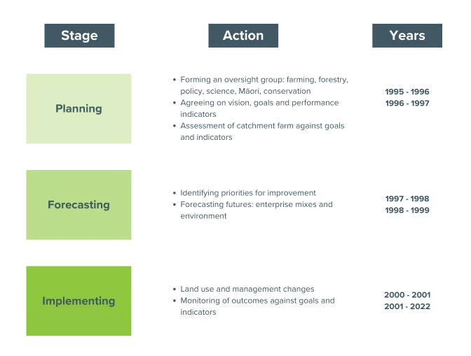
The project went through three distinct phases of planning, forecasting and implementing land use change. The first critical step was the establishment of a multi-stakeholder oversight group. This comprised representatives from research, policy and practise: AgResearch (social and farm systems research), NIWA (environmental research), Manaaki Whenua Landcare Research (environmental research), Waikato Regional Council, Waikato District Council, Department of Conservation, Federated Farmers, individual farmers, foresters and local hapuu Ngaati Maahanga.
Once the multi-stakeholder group had worked collectively to establish goals and indicators, a case study block was selected. This area was approx. 300 hectares of hill country pastoral land in the upper headwaters of the Mangaotama Stream, which drains into the Waipa River below Whatawhata township. The block had been part of the Whatawhata Research Centre since the 1970s.
Timeline
Catchment farm system
Some key characteristics of the case study catchment farm, typical of much of the western Waikato hill country pasture lands, include:
Pre 2000:
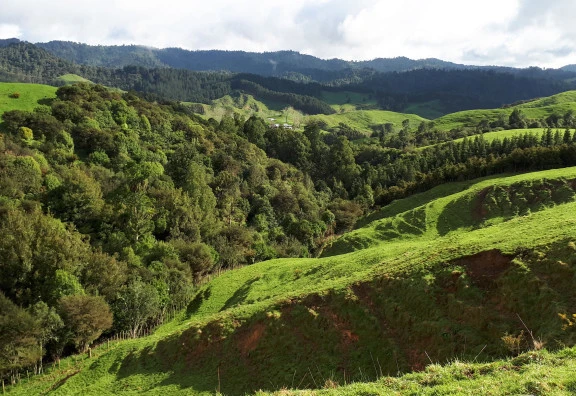
- 296 hectares of steep, low altitude, hill country
- Mild temperate climate prone to short-term summer drought
- Waingaro steepland sedimentary soils and Mairoa ash soils on ridges
- 75% of land prone to erosion – classified as Land Use Capability Classes 6 and 7
- Good fencing, stock water and access tracks as part of the research station
- 20 km of flowing streams
- 8 hectares of remnant native bush in 7 gully fragments
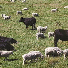
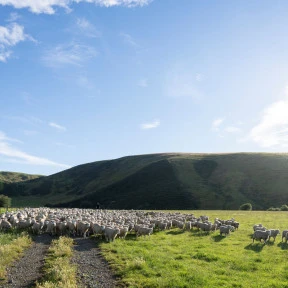
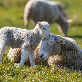
- Romney sheep and Angus cattle breeding livestock enterprises
- Lots of weed issues: gorse, blackberry, foxglove, inkweed
Key elements of the land use and management change decisions made by the multi-stakeholder group in 2001 include:
Post 2001:
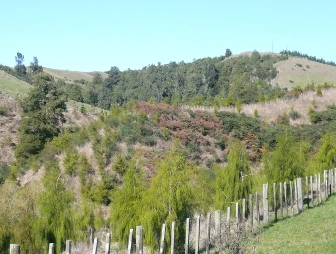
- 153 ha of Pinus radiata forestry (52% area), high tree density, single-thinning silviculture on the most erodible and weed-prone areas.
- 128 ha of intensified pastoral (43% area), increased lambing production and facial eczema tolerance through improved sheep genetics, 18-month bull beef enterprise to minimise heavy cattle damage to hillslopes, tactical use of nitrogen fertiliser in autumn, space-planted poplar poles to stabilise soil in small gullies unsuitable for forestry, fenced almost all streams
- 15 ha of native forest restoration (5% area), mixed-species native shrub riparian plantings around existing bush fragments, small kauri & totara plantations
Monitoring: 1996-2020
Monitoring of waterways within the catchment farm had been in place since 1996 and much data on farm performance was available from research records. This provided a baseline against which the outcomes of the land use and management changes could be compared. Post-2001, monitoring focused on three areas: farm business performance, ecosystem health (particularly water and native forest) and environmental performance (particularly water quality and greenhouse gas balance).
| Sustainable Business | Healthy Ecosystems | Environmental Performance |
|
|
|
Results
A number of key indicators responded as expected to the management changes, such as livestock fecundity, meat production, enterprise profitability, stream temperature, aquatic invertebrates, forest regeneration. Other indicators did not. For example, there is no evidence after 20 years of any reduction in nutrient and sediment concentrations in water, although catchment flows have declined following tree planting across approximately 60% of the land area.
Farm performance:
The changes in the sheep and cattle enterprises, in combination with the shift to soils with greater inherent pasture productivity, substantially improved meat production and profitability.
|
|
Pre-2001 | Post 2001 |
| Stocking rate (SU/ha) | 8.8 | 10.0 |
| Sheep:Cattle (SU wintered) | 61:39 |
64:36 |
| Lambs weaned (%) | 109 | 126 |
| Lamb production (kgLW/ha) | 116 |
217 |
| Beef production (kgLW/ha) | 86 | 232 |
| Wool production (kg/ha) | 26 | 27 |
| Sheep GM ($/SU) | 30 | 45 |
| Cattle GM ($/SU) | 41 | 82 |
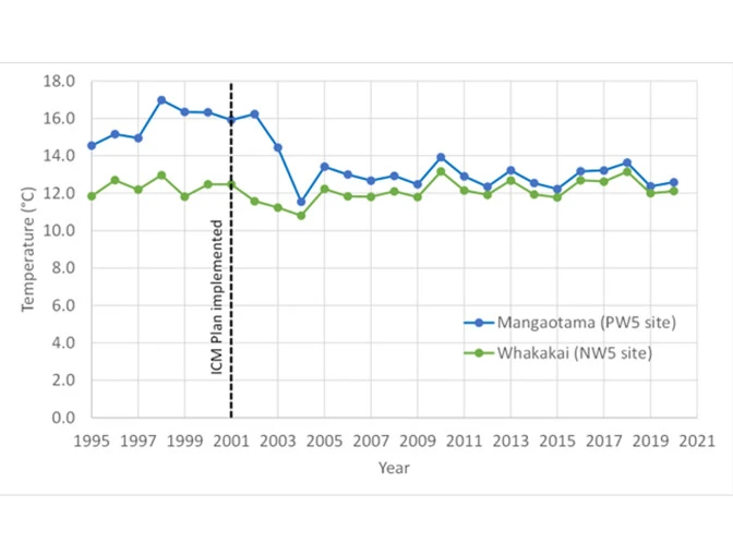
Aquatic habitat:
Reduction in stream temperature as a result of increasing riparian tree cover that shades streams. This improves habitat for sensitive aquatic invertebrates that a food for freshwater fish (eels and whitebait species
Forest health:
Regeneration of understory native plant species as a result of fencing livestock out of gully bush fragments. These plants will eventually fill forest gaps when canopy trees age and fall over in storms.
Biodiversity data set available
Download (xlsx 290 KB)Long-term water quality monitoring dataset
Read morePublications
Sediment-related water quality of small hill-country streams near Whatawhata, New Zealand. Response to integrated catchment management (ICM)
Read the full paper (subscription)Improving the economic and environmental performance of a New Zealand hill country farm catchment: 4. Greenhouse gas and carbon stock implications of land management change performance.
Read the full paper (subscription)The economics of transformation toward sustainable hill country land use
Read the full paper (open access)Before and after Integrated Catchment Management in a headwater catchment: Changes in water quality
Read the full paper (subscription)Transformations towards agricultural sustainability in New Zealand hill country pastoral landscapes
Read the full paper (subscription)Project partners
Funder
Tainui Group HoldingsKey Projects
Research
Related People
Our People
Latest News
News
Pasture Biotechnology update #3

Scientists Scott Knowles and David Hooks to grow high-performance materials in space
Bioeconomy Science Institute to research methane inhibitor for grazing livestock
New sheep trial aims to boost lamb survival and flock resilience